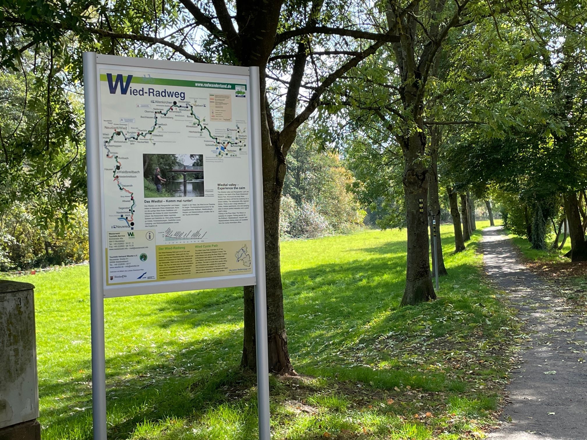
The Wied cycle path has 16 new cycle tourism information boards in the municipalities of Hachenburg, Altenkirchen-Flammersfeld, Asbach, Rengsdorf-Waldbreitbach and the town of Neuwied. In our VG at the locations Roßbach, Waldbreitbach and Niederbreitbach. They show the routes with towns and places of interest and provide good orientation for cycle tourists. Train stations, tourist information and useful information on the immediate surroundings are also marked.
The Wied Cycle Route covers 97 km across the Westerwald. The tour always follows the River Wied and is mostly flat to slightly sloping and also suitable for inexperienced cyclists. The wooded surroundings in the middle of various nature reserves offer peace and relaxation. Alongside the Nister cycle path, the cycle path is one of two river cycle paths in the region. Information on both tours and more can be found in the free brochure "Cycling in the Westerwald" and online at www.wiedtal.de/radfahren/